· 24 min read
What’s Up With You and Trolleys?
A hundred years ago, an electric interurban ran every 30 minutes through the three-stoplight town where I grew up. Nobody told me. Here’s how what’s left of “The Shore Fast Line” inspired me to start connecting rides with transit apps.
Topics: Shore Fast Line, Interurban, South Jersey, Atlantic City, Ocean City, SEPTA, NJ Transit, Trolleys, Public Transit, Transit History
A few hundred yards from my childhood home, a paved bike path runs through the grass median of Wabash Avenue, the north/south street running through my hometown. Patcong Avenue intersects this bike path on Wabash, just south of Belhaven Middle School, where I attended grades 5–8. The next intersection to the south of Patcong is at Seaview Avenue, which lends its name to the elementary school where I attended grades 1–4.
At both cross streets, you'll find unusually high concrete curbs protruding from nothing at all in the flat grass beside the asphalt path. You would not think twice about them, even if you—as I—challenged your childhood friends to traverse these curbs on bikes without falling on the way to school each day.
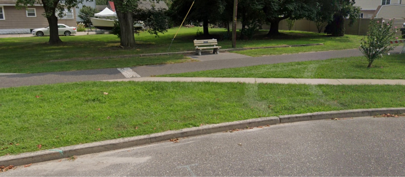
See: Curb Behind Bench, Patcong Avenue, Linwood, NJ
Google Maps Street View
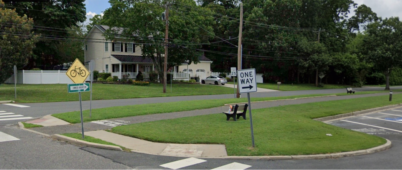
See: Curb Beneath Phone Pole, Patcong Avenue, Linwood, NJ
Google Maps Street View
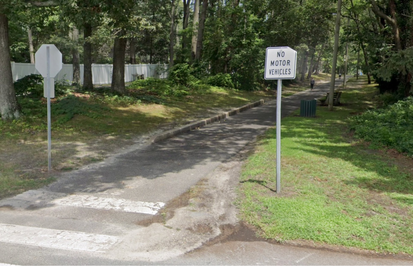
See: Curb at Left, Seaview Avenue, Linwood, NJ
Google Maps Street View
These curbs, it turns out, are clues. I was treading on profound, largely forgotten history.
Linwood
These curbs are located in the town where I grew up: Linwood, NJ, some 60 miles east of Philadelphia, across the bay from Atlantic City. When I was a very young boy in the early 1990s, disused railway tracks running through town were removed. By that time, I am told, the tracks were being used to transport lumber. My memories of the rails are vague and almost certainly from the vantage point of a kindergartner, seated in the back of my dad's Saab 9000: just rusted tracks running down the middle of the wide, grassy median of Wabash Avenue, the sleepy, 25mph central roadway through town.
A newly paved path was constructed in their place. I've learned from Google Maps that—in Linwood, at least—its official name is the "George K. Francis Bikeway." I'm 38 years old, I don't know who Mr. Francis was, and I have never heard a single human being refer to the thing as anything but “the bike path.” Looking back, the conversion was technically an early "rails-to-trails" initiative — long before this was cool, mind you — and it proved prescient. Easy access to the bike path became a real estate perk almost immediately. Today, it is Linwood's most distinguishing feature.
I used to love the bike path, and — as Mitch Hedberg might have quipped — I still love the bike path, too. As a kid, I spent untold hours perched atop my Mongoose Menace with no place in particular to go, pedaling thoughtlessly to the nonsensical, lento metronome of my pre-Internet childhood's daydreams.
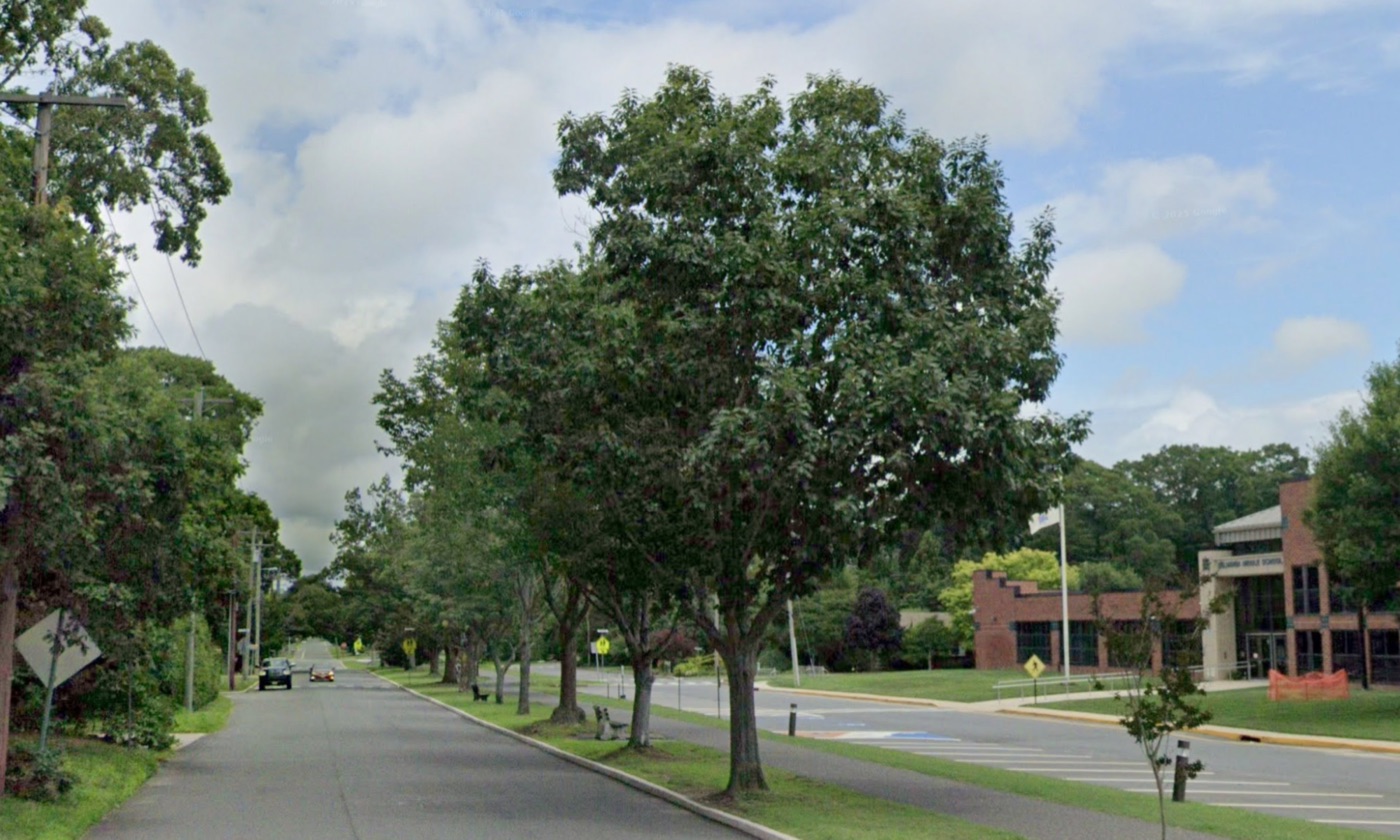
Bike Path on Wabash Avenue, Linwood, NJ
Credit: Google Maps Street View
Ride the path north to Maple Avenue and you'll find the most obvious evidence of its railway predecessor: a tiny, replica train station in the grass, labeled LINWOOD on its east-facing placard. A few feet south stands one of those white, old-timey, X-shaped signs reading both RAILROAD CROSSING and LOOKOUT [sic] FOR THE LOCOMOTIVE. It’s charming. My memories of the “train station” are vivid, but none of them have anything to do with trains. If you can believe it, I don't think I was especially cognizant of the fact that the “train station” signified a once-operating, actual train station. My friends and I used to challenge each other, on our skateboards, to ollie over the strip of grass separating the "station" from the path. All that I knew about the train station was that it had a platform from which I desired to launch myself. This is not, perhaps, as adolescent nor as irrelevant a detail as it initially sounds.
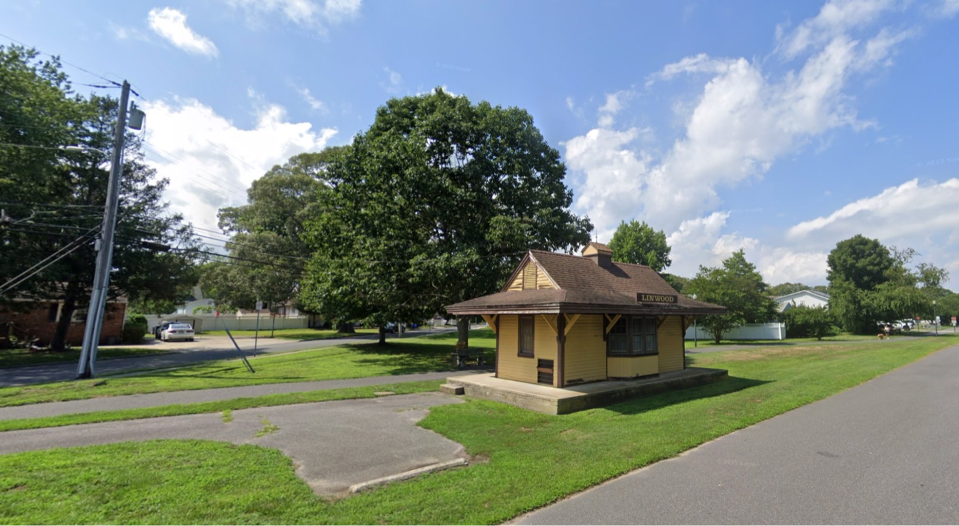
Train Station, Linwood, NJ
Credit: Google Maps Street View
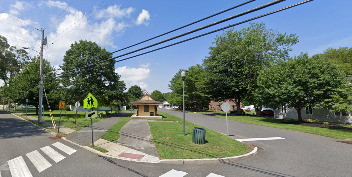
Train Station, Linwood, NJ
Credit: Google Maps Street View
From the train station, one can turn around and ride south, past the high curbs protruding at Patcong and Seaview, and across Ocean Heights Avenue into Somers Point. There, look to your left: in the grass median, you will find two small, squared-off gazebos of unfinished wood, each with a wraparound bench inside, each covering about the same footprint as the Linwood station, and each carrying naming placards on its north and south sides.
At West Wilmot Avenue: GLYN NEATH.
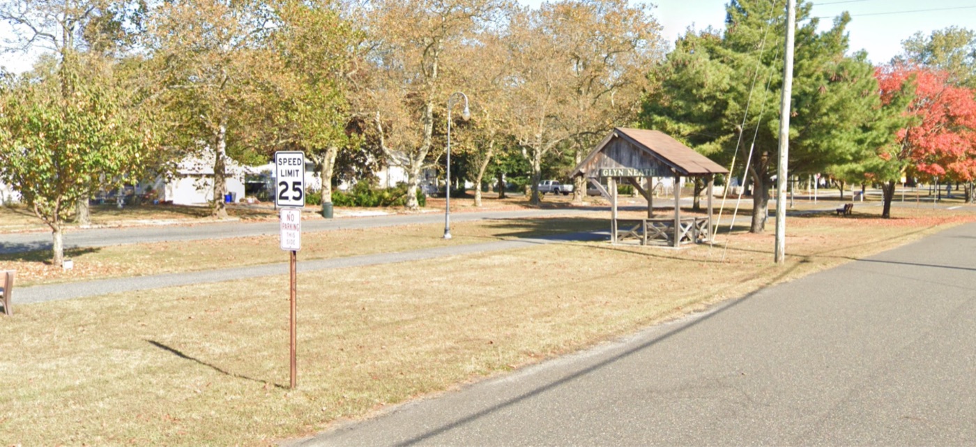
Glyn Neath, Somers Point, NJ
Credit: Google Maps Street View
Further south, at Groveland Avenue: LAUNCH HAVEN.
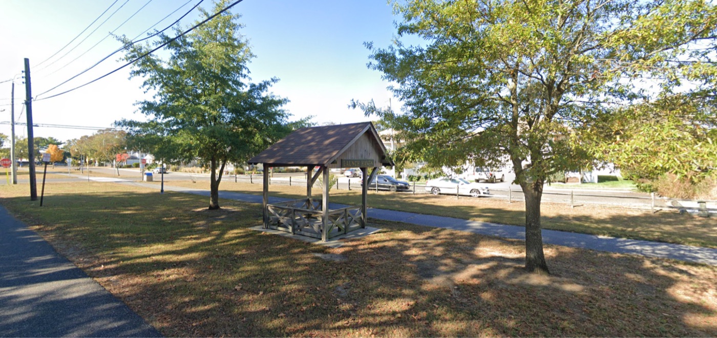
Launch Haven, Somers Point, NJ
Credit: Google Maps Street View
To the bike path’s innumerable bikers and joggers, these are convenient, quaintly named spots to take a shaded stretch break or wait out a summer shower.
To those who know, LINWOOD, GLYN NEATH, and LAUNCH HAVEN are former passenger stops on a rapid transit rail line. Those high curbs at Patcong and Seaview Avenues marked the platforms’ edges for the “BELHAVEN” and “SEAVIEW” stops, respectively. These were the exact spots where legions of passengers once stood in line, waiting to depart for their work days. These were the exact spots where tired commuters returned from the islands to their families for dinner back at home.
The Shore Fast Line
From 1907 to 1948 — long before I was born, before even my parents were born — the rails I saw with my own two eyes carried trolleys, providing all-day service to South Jerseyans on The Shore Fast Line: a fully electrified interurban running through my little town. Every 30 minutes, one could catch a trolley running between Atlantic City and Ocean City on a mostly dedicated right-of-way.
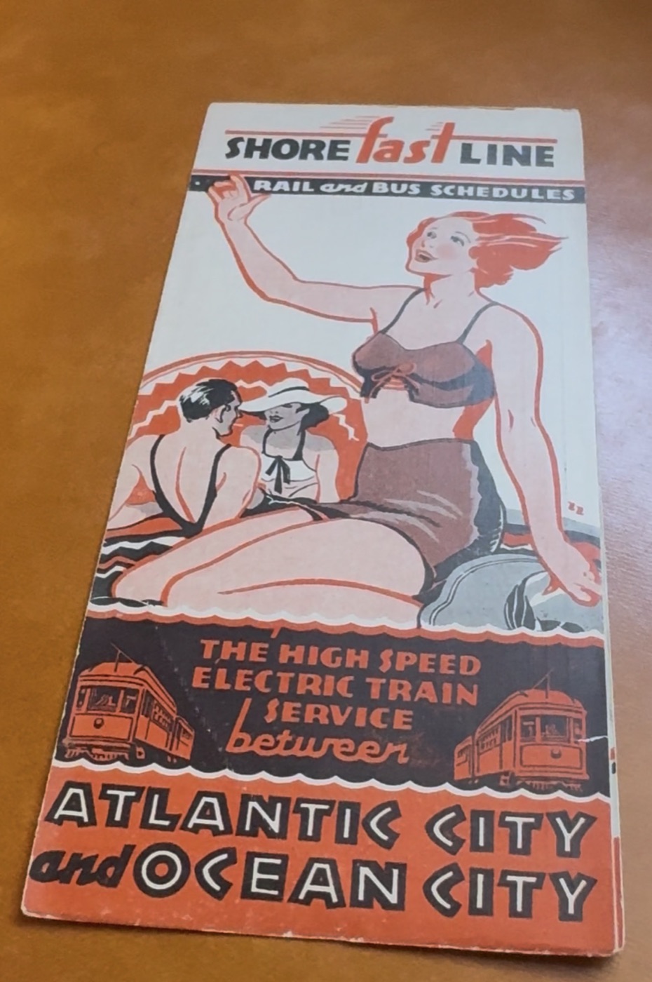
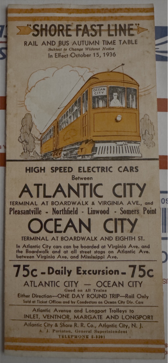
The Shore Fast Line - Timetables: 1935, 1936
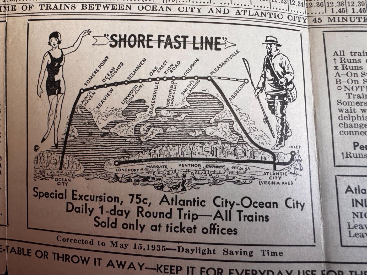
The Shore Fast Line - Timetable Map: 1935
Mere steps from my childhood home — in a three-stoplight town of 7,000 people or so — there was a rapid rail transit line most comparable to those now serving thousands of passengers per day in and around Philadelphia.
The contemporary character of Linwood is such that the notion of a fast, electrified rapid transit railroad running through it approaches absurdity. Where would such a railroad go? Who thought this was a good idea? Weren't there basically just a few farms and fishermen along the bay here 100 years ago? I was shocked. To give you a sense of my surprise: imagine fishing in your small town's pond where you have fished hundreds of times before, when a fellow angler casually informs you that the pond was previously the site of a Saturn V rocket launchpad, a 50,000-seat baseball stadium, or a nuclear powerplant… within some residents' living memory.
How could this be? I only learned of The Shore Fast Line in my 30s. Did everyone simply forget to tell me?
Apart from a couple of curbs, there is nothing — and I do mean nothing — else to suggest that 100 years before I loitered around my middle school, rail passengers stood there reading newspapers and making small talk on station platforms before rocketing off toward Atlantic or Ocean City.
What, Exactly, is an Interurban?
The Shore Fast Line was, on some level, difficult for me to picture because only a handful of systems like it remain in this country. Sure, like most train lines, there were rails, electricity, cars, and stations. It was not, however, necessarily a "train line." It was a far cry from modern, heavy commuter arteries like NJ Transit's Atlantic City Line or Montclair-Boonton Line. Though it had frequent departures, it was not a "metro," either. It was even less like the Broad Street Line in Philly or the New York City subway. Of course, it was not quite a "trolley line" either, at least not in the way that Philadelphia's T1–T5 are trolley lines, though the T is somewhat closer.
Now that you know what The Shore Fast Line was not, what exactly was it?
It was a once-widespread combination of all of these transit modalities. Though only a few remain, there was — and still is — a word for it: interurban.
An interurban is what it sounds like: an electrified, high-frequency rail line designed to move riders from one suburban area to another. Smaller than a train, but generally larger, faster, and covering more ground than a city trolley, interurbans are characterized by frequent, all-day service (usually 30 minutes or less). They typically run one or two cars at a time on their own right-of-way between the denser communities at each end of the line. Then, once they are "in town," near each ending terminal, the cars customarily leave their right-of-way to become street-running trolleys amid regular automobile traffic. These final stretches are designed to bring passengers closer to their destinations.
The Shore Fast Line did exactly this: from two boardwalks along the beach, trolleys launched themselves into automobile traffic on 8th Street in Ocean City or Atlantic Avenue in Atlantic City. They would then hook west, shooting up to about 50mph across the bay on their own traffic-free trestle above the tides — varying their speed accordingly — to make stops throughout the emerging mainland towns between the islands.
The interurban transit model is incredibly useful. Historically, the destinations at either end of the interurban lines were rail terminals. The Shore Fast Line, true to its type, did not simply connect two towns; it connected its catchment area to... everything. In those days, from Atlantic City and Ocean City, Shore Fast Line riders could easily access Camden, Philadelphia, and the country beyond.
Consider the magnitude of The Shore Fast Line's effects on locals’ lives:
100 years ago — during the Coolidge administration — residents of Pleasantville, Northfield, Linwood, and Somers Point could walk down their street and expect that within 30 minutes, an electric interurban trolley would arrive, whisking them swiftly to a rail terminal. There, riders could transfer to a proper train toward Philadelphia and the rest of the United States. One would walk less than a mile. One would wait less than one hour. Since The Shore Fast Line also had a companion service running down the middle of Atlantic Avenue from Atlantic City to the "downbeach" communities of Ventnor, Margate, and Longport on Absecon Island, a car was hardly necessary to get just about anywhere at all.
100 years ago — more than a decade before the start of World War II — residents of Pleasantville, Northfield, Linwood, and Somers Point (along with those of Ocean City and Atlantic City) enjoyed an astonishing level of transit convenience, exceeding today's standards by so much that it is downright laughable.
Over the last century, we lost far more than The Shore Fast Line. We lost our baseline, societal expectation for rapid rail transit's convenience and connectivity. We have conditioned ourselves to expect far worse transportation circumstances: expensive car ownership, ever-increasing traffic, poorly funded and incredibly limited rail transit options. Today, there is only one rail line connecting Atlantic City with Philadelphia. It features only one off-island stop (in Absecon) within a 30-minute drive of the four mainland towns serviced by The Shore Fast Line. No trains connect Atlantic City with New York. No trains reach Ocean City at all.
The Atlantic City area is hardly alone in having it far worse today vs. a century ago. The Shore Fast Line's interurban rail transit model is all but extinct, except for a few surviving examples.
Oddly enough, of the few that remain, three are in or close to where I live: Philadelphia, PA.
SEPTA Metro | M Line
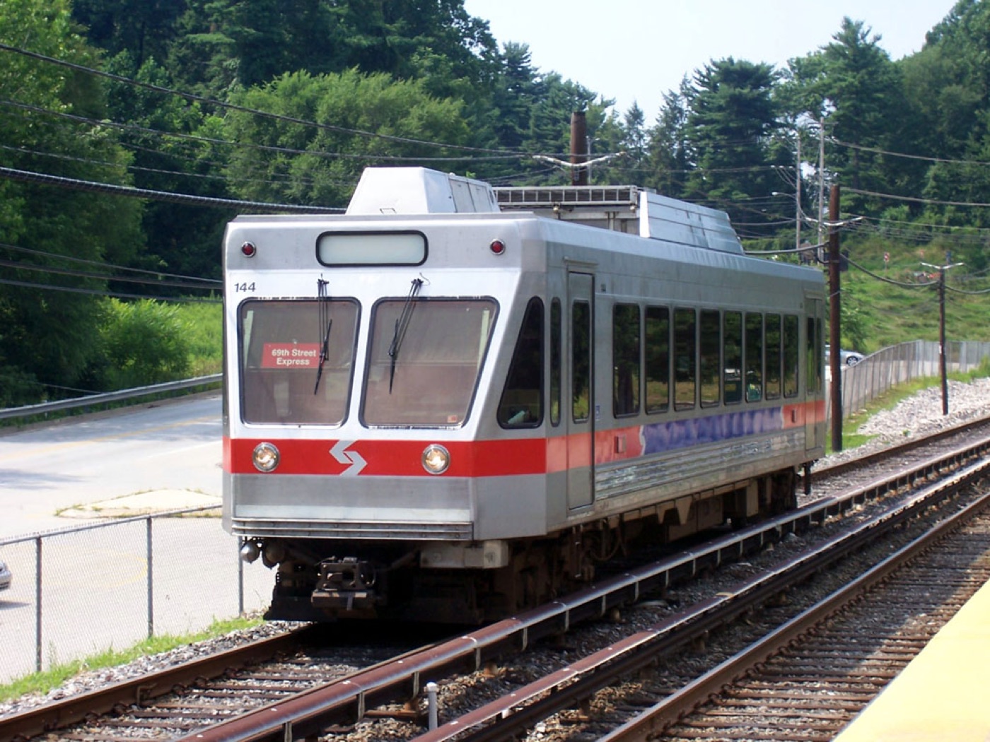
The M Line in Motion: SEPTA N-5 train approaching Gulph Mills Station, bound for 69th Street.
Photo: Adam E. Moreira, Wikimedia Commons, CC BY-SA 3.0

The M (formerly: "Route 100," or the "Norristown High Speed Line," or the "Philadelphia & Western," or the "P&W," or the "Pig & Whistle") is perhaps The Shore Fast Line's closest living relative. Its many monikers reflect both its ownership changes as well as its identity changes. Its service and utility to the wider community, however, both remain consistent.
The M is a fully electrified rail line with a dedicated right-of-way, on which one large-trolley-sized car at a time departs every 30 minutes toward two connected metro areas: Norristown and Upper Darby. The M does not enter Philadelphia at all. As one does on a bus, M riders signal to the operator when they'd like to get off at the next stop. Some communities along its route rank among the wealthiest in the country. That is not, I would suggest, a coincidence. It is what great interurban transit accomplishes: unobtrusive, reliable service to already-connected nodes. Some of these planned communities were appropriately known as “streetcar suburbs.”
It takes about 30 minutes to ride the M from end to end, covering 22 stops and roughly 13.5 miles. In its 2025 Route Statistics release, the M was ranked #1 in SEPTA’s “suburban” transit division (which spans two trolley lines and many buses) in terms of weekdays’ daily average ridership (p. 7), averaging 5,108 passengers per day (p. 34).
SEPTA Metro | D1 & D2 Lines
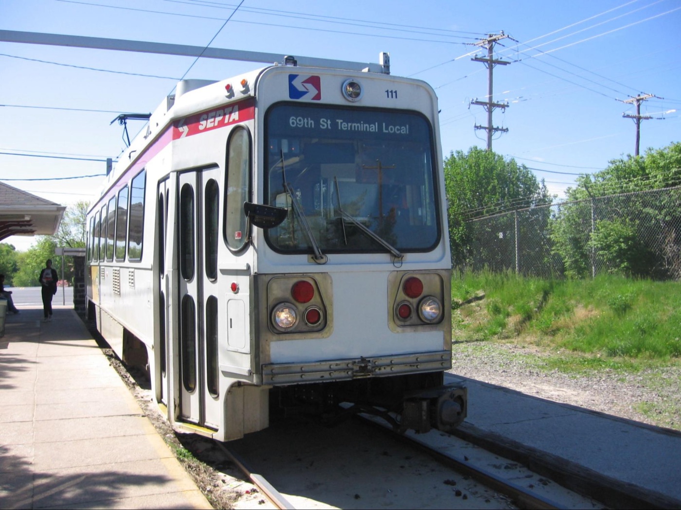
A Route 102 [Now: D2] trolley at Sharon Hill terminal, 2001.
Photo: Danntm, Wikimedia Commons, CC BY-SA 3.0

Perhaps 10 miles from the M are the SEPTA Metro D1 and D2, the former Red Arrow (i.e., Route 101 & 102) trolleys toward Media and Sharon Hill. These too still connect suburban areas at each end of their fixed rail links every 20–30 minutes, running partly on their own rights-of-way and partly in the street beneath overhead catenary wire, exactly as The Shore Fast Line once did.
NJ Transit | River LINE
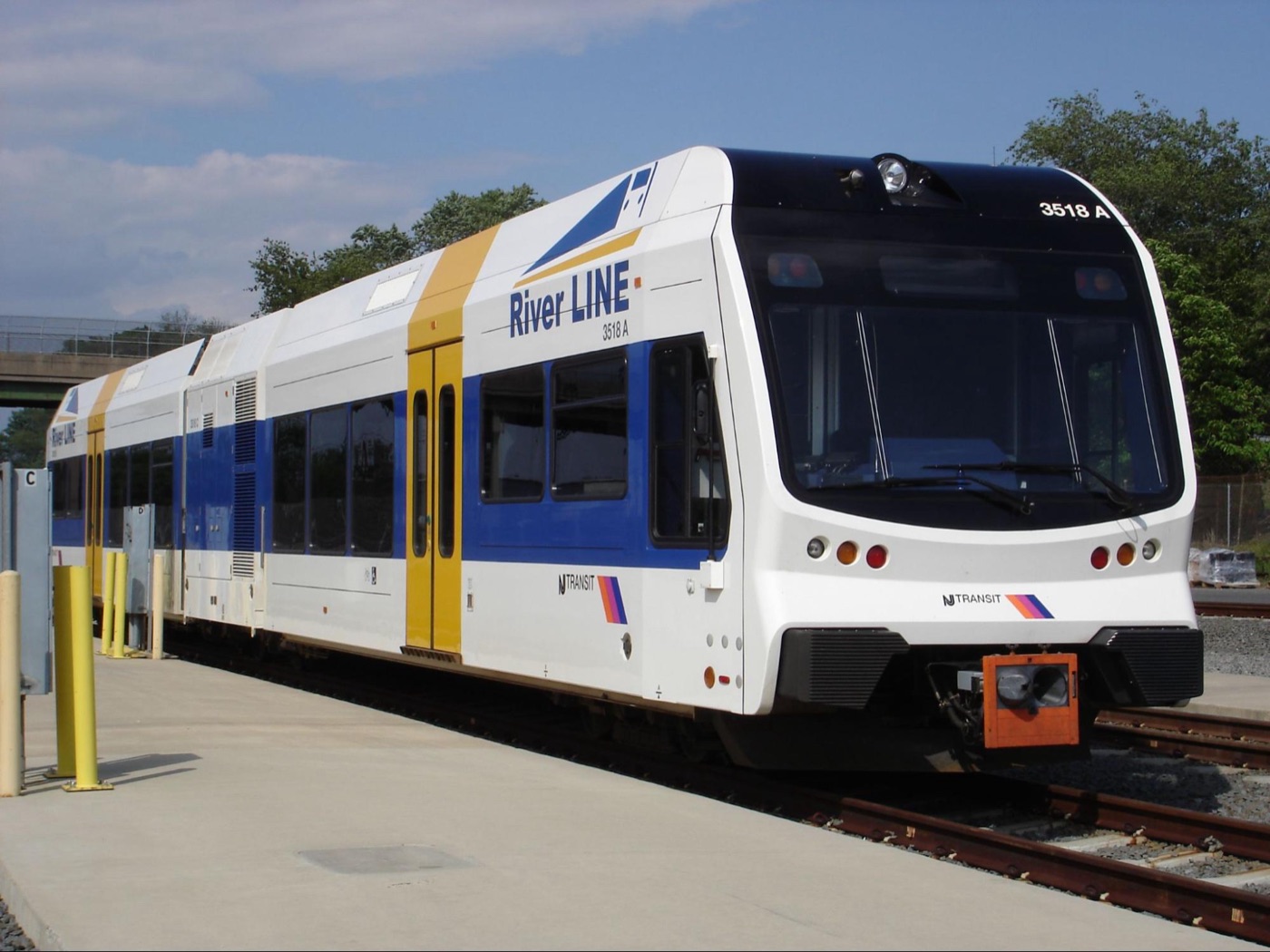
A River LINE Stadler GTW railcar, 2006.
Photo via Wikimedia Commons, public domain

Across the Delaware, NJ Transit's River LINE links two other satellite, urbanized areas—Camden and Trenton—albeit with larger, light-rail rolling stock. Curiously and somewhat controversially, it is not powered by electricity at all. It is powered by diesel. Each of these interurban lines deserves a post of their own, and they will soon get one.
Linwood, 1930. Camden, 2040.
The interurban model’s perks are many and obvious. The M, the D1/D2, and the River LINE make it possible for thousands of commuters to live up to 30+ miles from Philadelphia and commute to the city each day without a car. Yet, by some definitions, these are among the last operating interurbans in the US.
All three of these survivors are nestled in the long-ago-settled, cozy suburbs of one of the oldest major American cities. Here, an interurban cluster looks deeply sensible on paper: the Philly metro area is densely populated. It is, demographically, exactly the sort of place where American rail transit tries to make a case for itself. Right now, for example, a fourth interurban—the Glassboro-Camden Line—is in the “preliminary engineering design” phase. According to its website, the “GCL” has a projected daily ridership of 16,000 by 2040. As of this writing, renderings and design considerations resemble the River LINE a great deal.
How, then, did The Shore Fast Line run for 41 years in a place lacking not only population density, but population? No planner alive today would dare to propose it.
It was possible because The Shore Fast Line provided far more than a quick, convenient ride.
According to the 1930 census, Linwood's population was only 1,514. According to its 1936 timetable, The Shore Fast Line stopped there roughly 80 times per day. Then and now, this math makes no sense at all. The combined 2020 population of all towns once served by The Shore Fast Line was 96,229. In 1930, it was 89,634. This is a difference of only 6,595. Within the scope of rail transit infrastructure planning, this is so insignificant a change that it is practically a rounding error. In terms of the total people served, The Shore Fast Line existed for a nearly identical population to the one that exists today.
In 1930, one year after the crash of 1929, when Americans were stripped of their savings, struggling with the cost of living and scarce job opportunities — sound familiar? — The Shore Fast Line must have been a lifeline.
A person could live, without a car, in Linwood and find employment elsewhere. Anyone living within reasonable walking distance of a Shore Fast Line stop (which, by the way, was almost everyone in the mainland communities) could depend on — at nearly any time of day — a brief, predictable wait before speeding off toward the promise of work in the resorts at either end of the line.
And if there were no opportunities in Atlantic City or Ocean City?
The interurban model worked its magic: both terminals featured rail service toward Camden and Philadelphia. Just as the Glassboro-Camden Line promises that its 2040 riders “will be able to extend their trips” from Camden’s Walter Rand Transportation Center, a working-class Linwood resident could expect — again, in 1930 — to walk a short distance and, using public rail transit alone, commute to Philadelphia and back. It would have been a long day, but it was possible. I almost forgot to mention: The Shore Fast Line ran well past midnight.
Consider the 1936 schedule.
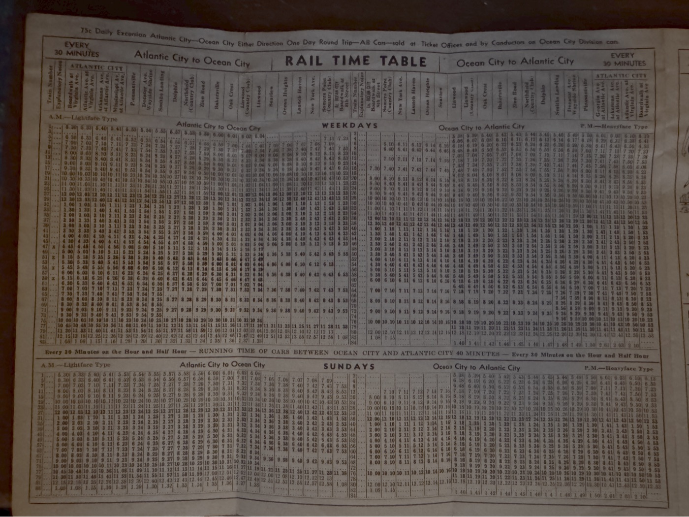
The Shore Fast Line - 1936 Timetable
Own Content
At any time between 5:30 AM and 1:03 AM, one could board a trolley — again, every 30 minutes or less — at the boardwalk (yes, at the actual boardwalk) and Virginia Avenue in Atlantic City. From there it stopped throughout Atlantic City, Pleasantville, Northfield, Linwood, and Somers Point before swinging back over the bay to its concluding stops in Ocean City. Eighteen marked stops. Total travel time: 40 minutes. Seven days per week.
The Shore Fast Line route from boardwalk to boardwalk was 16.4 miles (Borgnis, 1979, p. 206). Today, Google Maps tells me a passenger car making no stops whatsoever between boardwalks does so in 35 to 45 minutes.
What Replaced The Shore Fast Line
When I turned 14 in the early 2000s, I got my first summer job on the Ocean City boardwalk. My entry into the workforce came alongside my first foray into relying on "modern" public transportation. Working on the boardwalk during the summer was a rite of passage for many of my peers, but getting there from the mainland without a driver's license meant depending on the bus. Thus, I spent countless hours standing near the flower shop on Patcong Avenue, craning my neck to see if I could sight the NJ Transit 507 barreling southbound on Shore Road toward Ocean City. The 507 runs the same route to this day, covering 12 miles and some 58 stops in about an hour. Around rush hour, buses arrive roughly every 30 minutes; off-peak, they arrive roughly once per hour. Of course, as Shore Road runs a single lane in each direction with no broken center lines for passing, buses sit in the same traffic as cars.
I can’t speak to the 507’s efficiency now. In those days, though, the buses' timing was erratic. On summer Fridays and Sundays in particular, as the islands emptied and filled, it was anybody's guess as to when the 507 would arrive. I usually waited there alone, but on summer weekends I had plenty of company. The bus delays were due in part to the now-realigned Somers Point traffic circle and the old 9th Street drawbridge leading to Ocean City. This combination — of out-of-town tourists, a dual-lane traffic circle, and an aging bridge that became stuck in the "open" position on days hot enough to cause its metal to expand — left me and many others with a bad public transit taste in our mouths.
I cannot imagine how I would have felt if I had known that The Shore Fast Line had its own right-of-way sequestered from traffic, that it ran even closer to my parents' house than the buses on Shore Road, that it arrived every 30 minutes, and that it had its own trestle separated from traffic going over the bay. With a Shore Fast Line, how many more summer beach days would be enjoyed by mainland residents? How many more seasonal businesses on the island would thrive year-round? How many more tourism dollars would be spent in mainland towns connected with rail infrastructure to the beaches at both ends? How many more day trips would be taken to Philadelphia? How many more job opportunities at the Camden and Philadelphia healthcare hubs would become accessible to shore residents?
The list of questions goes on, unanswered.
We Expected More
The Shore Fast Line became my minor, private obsession. I found myself reading about it late at night, sifting through universities' and private collections' digital archives for evidence of its existence: rolling stock identification numbers, historical accounts, posts from trolley people on trolley forums about trolley things. I took some comfort in learning how many of these same trolley people lamented their own rail transit losses. Newly emboldened, I ordered postcards celebrating The Shore Fast Line, photographs of its mere existence, rolling along as it did every day. On eBay, I bid on scans of old timetables. I sought vintage aerial imagery of the region to trace the locations of the infrastructure that sustained its operations. Once, I even drove around just looking for traces of it in a few places.
Yeah, I know, it's pretty weird stuff.
Just ahead of my 39th birthday here, my fiancée asked me (half) jokingly, "are trolleys going to be the weird thing that guys like you get into in their 40s?"
We'll see.
For now, what's weirder to me than my fascination with The Shore Fast Line is that a once-ubiquitous institution so obviously sensible, convenient, and economically powerful, is today not even worthy of a plaque somewhere. To me, this is not "somewhere," this is where I was born and raised. This is South Jersey: the region regularly relegated to the economic second tier by its more populous, wealthier, more dynamic northern half.
Sometimes, The Shore Fast Line's fleeting existence still feels like a joke is being played on me. I feel robbed — like some private heirloom was stolen from me before I had the chance to cherish it. Actually, no, it is not so private: I feel as though this is a public heirloom that was taken from everyone, from all of us. Now, each time I use a dynamic-price-gouging ride share app in the area, I get twitchy with frustration. "Once," I might say (unprompted, of course) to whomever is riding with me, "we had The Shore Fast Line."
Even after encountering trolley people, my residual rail transit aggravation in South Jersey knew no peer. It was only when I encountered one Mervin E. Borgnis, the author of a book on The Shore Fast Line, that I found someone who truly felt as I do. Writing in 1979 — only thirty years after the line stopped running — the book's title alone implied his incredulity: We Had a Shore Fast Line.
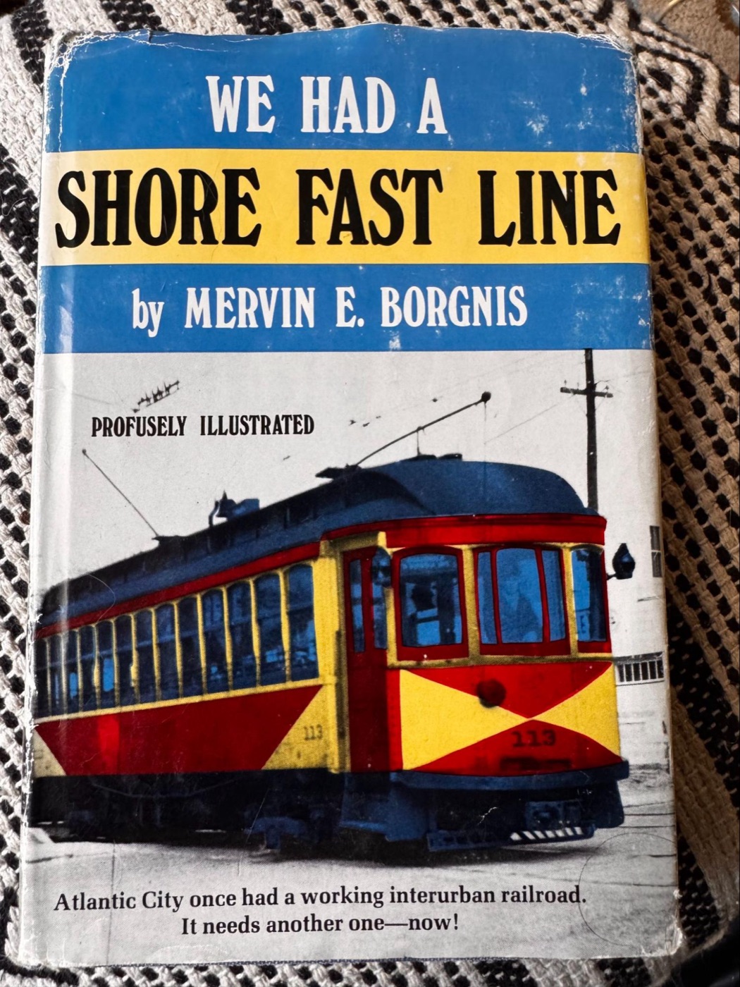
One of my two copies of We Had A Shore Fast Line, by Mervin E. Borgnis
In case the message is not clear, the subtitle on the cover reads “Atlantic City once had a working interurban railroad. It needs another one — now!” You should read it. It is comprehensive, it is illustrated, and it gives you some sense of how it felt to exist when the service served as the region's backbone. I read it in a single sitting. Strangely, I — almost instinctively — bought a second copy in better condition... just in case.
I had always assumed that my day-to-day life improves as the technology lubricating my life's machinations grows more sophisticated. I have access to a comfortable, air conditioned car. I can control the music as I drive. I have artificial intelligence and mobile internet access to point me in the right direction, and—if I do not want to drive—I have a host of ride share services to make my individual transport experience as bespoke as I…can afford.
Interestingly, I do not believe that most trips on The Shore Fast Line were taken for reasons all that different from those taken today. In 1930, riders longed to plant their feet in the sand and gaze wordlessly toward the vast Atlantic for hours at a time. They too wanted to walk on these same wooden boardwalks just behind the beaches, eat carnival food, drink lemonade, pop in and out of souvenir shops, and take their kids to the amusement park rides. They too wanted to get dinner, see a show, and book a room overlooking the sea.
It is hard to reconcile the fact that this was cheaper and easier 100 years ago.
The Bike Path’s Lesson
It is not all doom and gloom. Something genuinely magnificent came from the end of The Shore Fast Line, even if it took me 30 years to fully appreciate and understand it.
Only two north/south roads run through Linwood, and the bike path lies squarely in the middle of them. As a central, car-free thoroughfare, it has allowed generations of parents to grant their children early transit autonomy: as soon as you can ride a bike, you can safely reach all three of Linwood's schools. At any time of year, I am guaranteed to see kids conspiring around the path's benches, joggers logging mile times, dogs being walked, pleasantries exchanged. The bike path is not simply for fitness and transportation. It is for community.
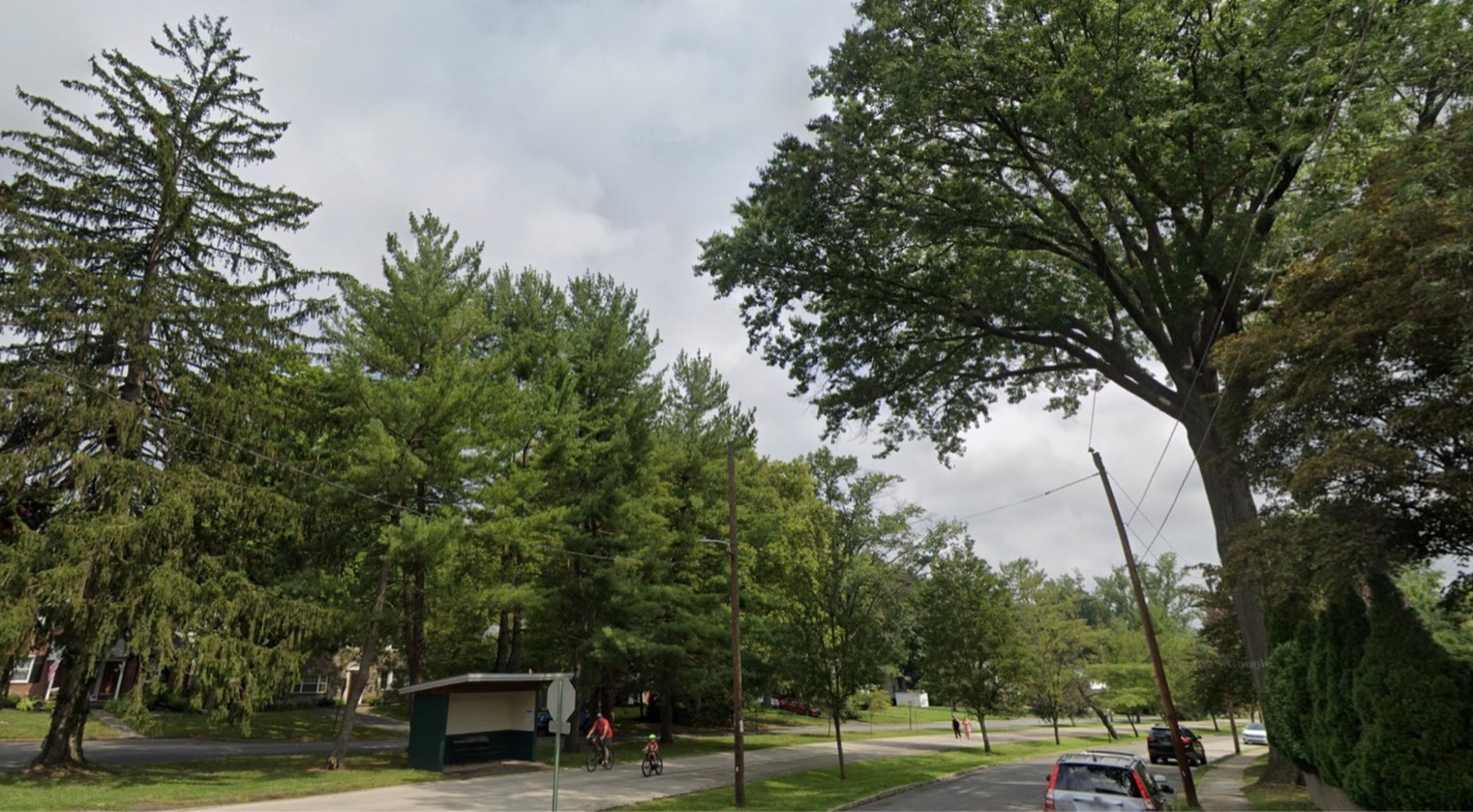
SEPTA Route 103 Busway - Havertown, PA
Credit: Google Maps Street View
Linwood was not the only town to pivot in this direction. Consider SEPTA Bus Route 103, a former Red Arrow (i.e., the company originally responsible for operating today's SEPTA D1/D2 trolleys) interurban line. These tracks were also dismantled and, in Havertown and Ardmore, replaced by a widely used, widely beloved walking and biking path. This one, though, even doubles as a car-free busway.
Poetically, the busway still runs right under the elevated SEPTA Metro M platform, suggesting the region's former connectivity and Havertown’s and Ardmore's "streetcar suburb" heritage. Like its distant cousin down in Linwood, Route 103's former trolley stops are marked by train station-esque enclosures, and the neighborhoods along its path are particularly desirable places to live.
It feels natural and uncontroversial to consider Linwood's bike path a dedicated, car-traffic-free, fixed transit link offering freedom of movement to the community.
Why, then, does it feel deeply controversial to suggest that rail-based public transit — like the line the bike path replaced — offers even greater benefits?
The Shore Fast Line taught the same lesson, to the same community, and it lies largely forgotten in the same little strip of grass on Wabash Avenue.
Why I Build Transit Apps
So, what's up with me and trolleys? Well, I build all kinds of apps for my work, but outside of my job, I simply love building transit apps.
I spent my childhood blissfully unaware of transit evidence that I could not read. Worse still, the evidence has faded from the living memories of all but a smaller and smaller cadre of elderly residents. Curbs marked rail platforms. Gazebos signified stations. The bike path was the right-of-way. Little clues, hidden in plain sight, to the prosperous past for which so many in Atlantic City’s shadow are so nostalgic — and nobody — not the town, not the maps, not the little replica station itself — ever translated these clues into a concrete semblance of the irrecoverable modernity that, ironically, ceased to exist before I ever came to know it. I only learned to read my own hometown's once robust transit infrastructure 20 years after I left it.
What is up with me and trolleys is not nostalgia… at least, not exactly. I never experienced The Shore Fast Line.
More than nostalgia, it is legibility. I am convinced that by making transit infrastructure—past and present—legible, we begin making the case for more of it.
Transit systems' efficacy is usually evaluated on indices related to efficiency, but their long-term viability is directly tied to legibility. It is a more complex notion, unmeasured by numbers; it is the ease with which we understand what moves (or, for now, moved) us. What we more easily understand, we more readily trust. What we more readily trust, we more frequently use.
Here is a testament to transit’s legibility:
Despite the film Who Framed Roger Rabbit, and despite the era not being so comparatively long ago, many Americans are oblivious to the fact that rail transit was ubiquitous in the first half of the 20th century. This excellent map by Jake Berman depicts the breathtaking extent of Philadelphia’s streetcar system in 1940.
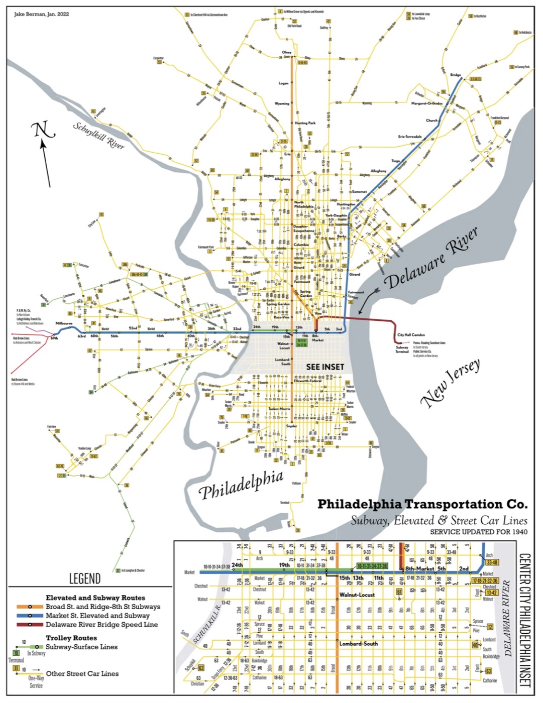
This is the level of rail connection that we once expected for a major American city. This is what happens when transit’s infrastructure is no longer legible: it is erased. I have a print framed in my home right now, and when I look at it each day, I see the lines that formerly connected my neighborhood to others. Even in Philadelphia, amid the ongoing struggle to convince Pennsylvania’s state legislature to responsibly fund SEPTA, it is telling that the political battles do not focus on expansion. The focus is not on restoring the vast connectivity Berman’s map illustrates. Today’s focus is primarily on an aging fleet’s maintenance and replacement.
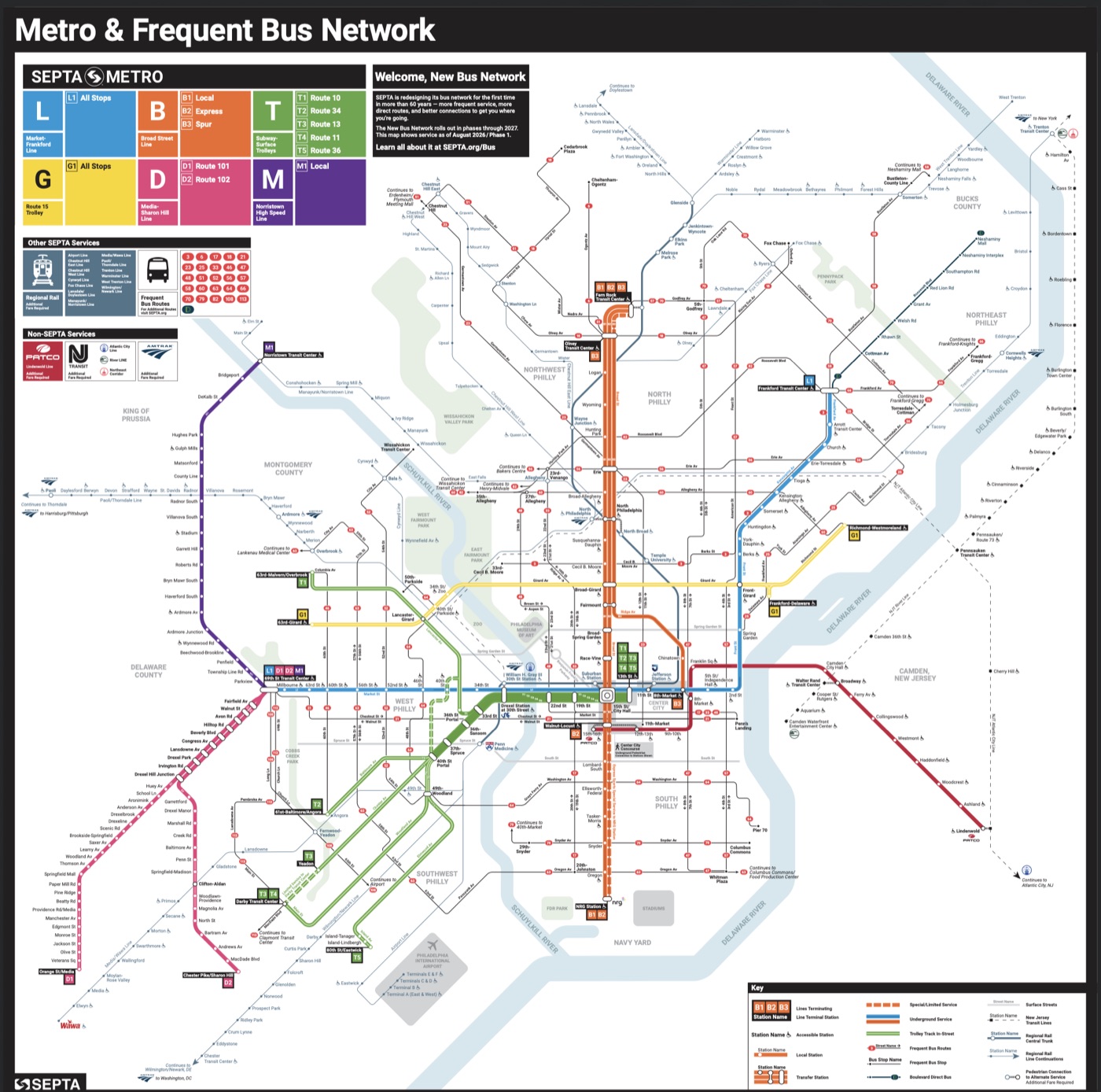
For its part, practically speaking, SEPTA itself understands legibility’s criticality. They recently rebranded their rapid rail transit services as SEPTA "Metro."
This being Philadelphia, I am certain the rebrand has detractors, but — personally — I think it is brilliant. In New York City, the subway functions — in spite of its origin as three entirely separate systems — as the same-old New York City Subway at every station. When I moved to Philly from NYC, I was disoriented:
"So these trolleys are sometimes subways? But these other trolleys are not? Were these route numbers picked randomly out of a bag? 10, 11, 13, 15, 34, 36, 101, 102? Wait, you mean these don’t correspond to any street numbering at all?"
"So the Norristown High Speed Line is not the Norristown-Manayunk Line that… travels at about the same speed… from the same station? I tap once for this one, but three times for the other?”
It was hard to figure out what went where, how ticketing worked, and why “regional rail” lines were different from other lines. The unifying SEPTA Metro rebrand did a great deal to consolidate Philadelphia’s rapid rail transit under a comprehensible umbrella. Nonetheless, there remains ample room for progress. I am continually surprised both by how many of my fellow Philadelphians are unaware of this rebrand, and by how many are unfamiliar with entire SEPTA services themselves. Some others — often for, admittedly, very good reasons — are aware of such services, but simply choose not to use them.
As SEPTA's years-in-the-works rebrand demonstrates: legibility matters.
At the same time, too much American transit is effectively illegible even to those standing next to it.
I build apps that attempt to make transit legible.
On its surface (no pun intended!), my Philly Trolleys app makes it easy for riders to catch one of the vintage, restored 1940s-era PCC trolleys running on the SEPTA Metro G (i.e., the Girard Avenue Line, Route 15) Line instead of one of the many SEPTA buses traveling the same route.
On a more, let's say, human level, my app simply makes it easy for would-be riders to know what kind of vehicle is coming to take them where they are trying to go. Much of public transit comes down to managing expectations: people like to know what is coming and when it is coming. It is not so much to ask.
My NJ RIDES app is more ambitious, but similarly simple in its ethos.
NJ RIDES is my attempt to wrangle and connect for New Jersey riders every single route available to them: commuter trains, interstate rapid rail lines, light rail lines, and hundreds of public buses, private buses, free and low-cost community shuttles, countywide loops, and local college shuttle systems. There is a dizzying array of overlooked, underused, sometimes publicly funded transit options that were, until now, largely uncatalogued.
These lines, together, cover wide swaths of the state that raised me. While making this app, I discovered dozens of services I never knew to exist. My hope is that users do the same. I know what happens to underappreciated services when nobody knows that they exist.
I cannot rebuild The Shore Fast Line.
I am not even convinced that anyone should rebuild The Shore Fast Line.
What I can do is make it easier for riders to take advantage of what transit options exist right now so that, as a society, we demand more of these options. This was once our expectation. It can be our expectation once more.
With Philly Trolleys, I try to make it easy to utilize and celebrate the existence of functioning tracks running down Girard Avenue. They are, after all, a rare exception to the rule. Perhaps Philly Trolleys users will enjoy riding PCC trolleys on Girard Avenue so much that they demand trolleys return to Germantown Avenue in Northwest Philly. There, today, you will find miles of intact rails embedded and unused in a restored cobblestone median — from Chestnut Hill through Mount Airy and beyond — beneath still-mounted, unelectrified catenary lines ready for trolleys that have not run there since the early 1990s.
Perhaps, with NJ RIDES, app users will discover a shuttle to the River LINE or PATCO and start to ask why there are not more interurban links to Camden or Trenton?
What's up with me and trolleys?
I like to make connections. I like to connect people. I like to go to new cities, and new neighborhoods within those new cities. I like to be among others, as was once more regularly our collective expectation.
Trolleys are feasible, predictable, reliable, and — unlike buses — bikers and pedestrians can more easily avoid colliding with trolleys: they know exactly where to look for them. Trolleys need not be nostalgic, antiquated, or quaint. They can be modern, efficient, and progressive. They can run via catenary wires, via rechargeable batteries, or even via sources embedded within the street itself.
We Americans — internationally infamous for loving large, fast automobiles — are beginning to widely embrace electric cars. My sincere hope is that we also embrace really big electric cars: the ones that run on tracks, that hold dozens of passengers, and travel unimpeded on a dedicated right-of-way between towns. On these, regular people can affordably sit, face-to-face with one another, peacefully and safely speeding along…together…
It could happen.
After all, a hundred years ago, we had a Shore Fast Line.
More soon, on trolleys and otherwise.
- Cris